
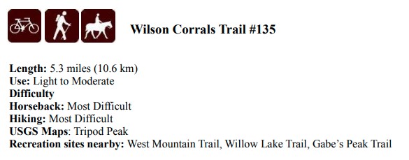
Information about Wilson Corral Trail
Trail Map


Trail Reroute Map
The lower section of Tr-135 has been closed due to a boggy section that is dangerous for stock and inpacts the water quality of the creek.
Details: Saturday 08:00 - 18:00
- Area
- Region
- Project Type
- Ride Difficulty Rating
- Work Difficulty Rating
Attractions and Considerations
The trail passes through open conifer/aspen forests and then travels an open ridge to an arm of Wilson Peak before descending to Squaw Creek. From the highest point of the trail there are good views of Snowbank, Wilson Meadow, and areas west. There are no sources of water for approximately the middle 3 miles. The first 3 miles of this trail are for multiple uses. The last 3.6 miles are designated for nonmotorized use. Motorized users may wish to turn around in the flat meadow at 2.7 miles instead of at 3.0 miles where the trail is steeper and narrow.
The Wilson Creek Trail starts at a well marked trailhead, ½ mile up National Forest Road 653Q (NF653Q). The trail itself starts at the north end of the open parking area. There is ample room to park, plus a dispersed campsite at the trailhead. (NF653Q) Not Suitable for Goose-Neck Trailers!


From intersection of State Highway 52 and the Sweet/Ola Road: go north on the Sweet/Ola Road (NF618). Just past the unsigned Third Fork Guard Station, turn right onto NF-635. Go east on NF-653 approximately 8 miles to junction with NF-653Q. This junction is signed for the trail. Turn left onto NF653Q and go 0.5 miles to sign "Wilson Corrals Trail". Turn right and park in the flat. The signed trailhead is on the north edge of the flat. Rammage Meadows and a couple of camp sites along the Creek on NF653 are also good camping with horse trailers,
DO NOT TAKE SECOND FORK ROAD, Even if your GPS Suggests it.
SIGN UP: Squaw Butte Event Registration System