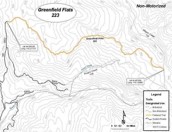
Camp at the Squaw Creek Trail Head; Ride west on NF-625 and travel to the junction with NF-646. Turn right onto NF-646 and about 1.8 miles to the
first switchback and NF-646C. Turn left onto NF-646C and travel 0.5 miles to the end of
NF-646C at its junction with NF-646D and an unnamed road. The trail is the unnamed
road that is covered with sharp rocks, and turns steeply uphill. NF-646 is not suitable for horse trailers.
|
Details: Saturday 08:00 - 18:00
- Area: Boise
National Forest
- Region: West
Central Mountains, Idaho
- Trail Head: North end of trail off FR-646C
- Project
Type:
- Horse
Camping - General Trail Maintenance
- Ride
Difficulty Rating
- 2 -
Moderately Technicial
- Work
Difficulty Rating
- 3 -
Down Tree removal & Brushing, minor tread work.
Squaw Creek
Tail Head
GPS:
44.47569,-116.21475
 |
 |
 |
 |
 |
| Attractions and Considerations
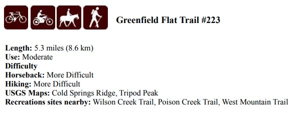
This trail is open for non-motorized uses only. Over-snow vehicles may use the trail from
Dec 1-May 15.
The Greenfield Flat trail is an old road that begins at the end of National Forest Road
646C (NF-646C). The trail climbs gradually then increases in steepness as it passes
through a mature pine forest and comes out onto a wide flat ridge top, where there is a
360-degree view. The trail travels through grasses and small aspens along this ridge,
while to both sides of the trail, dense forest and low brush exist. This ridge also serves as
a cattle driveway.
After crossing the ridge, the trail turns sharply and drops down onto the flats, which are
an expansive, gently sloping grassland dotted with an occasional clump of subalpine fir
and spruce. Once on the flats, the trail turns east again and climbs up through the flats to
a wide saddle where it ends at its junction with the Wilson Creek Trail. This junction is
not signed. The Wilson Creek Trail provides access to the Poison Creek Trail and the
West Mountain Trail. |
SIGN UP: Squaw Butte Event
Registration System |
| Pictures |
Project Leader: Rob Adams
208-781-0548 projects@sbbchidaho.org |
